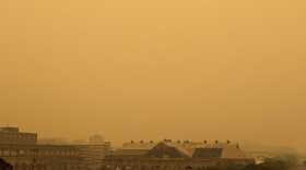
Bethlehem Live Weather Camera sponsored by St. Luke's University Health Network
-
 Easton is looking for a new conservation management apprentice, a position which will entail planting and maintaining urban trees throughout the city.
 -
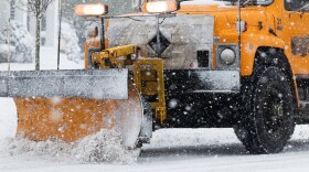
Several districts announced they would be closed Tuesday because of the weather forecast, which calls for 4 to 6 inches of snow in the Lehigh Valley.
-
The Lehigh Valley is under a winter weather advisory, and forecasters say every snowflake that falls will stick easily as the coldest air of the season moves in.
-
The International Space Station is easily visible from Earth just before dawn or after dusk. It gives off no light of its own, but reflects the Sun off its massive solar panels.
-
Pennsylvania’s economy will center around agriculture in 2024, according to Gov. Josh Shapiro.
-
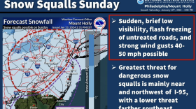
Snow squalls cause dangerous travel conditions and can be blinding for motorists, according to the National Weather Service. The Lehigh Valley is at highest risk from mid-morning into the afternoon.
-
The weather pattern not only remains active – with another flood watch on Friday – it includes a chance of yet another coastal system impacting the mid-Atlantic region early next week.
-
Another soaking rainfall and flood watch are expected for the Lehigh Valley on Friday, forecasters said, with widespread impacts somewhat similar to Tuesday’s storm. Then, we take a wintry turn next week.
-
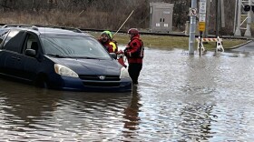
Ignoring repeated warnings, some Lehigh Valley motorists find themselves stranded after driving through deep roadway water.
-
Over two inches of rain fell at Lehigh Valley International Airport, setting another daily record on Tuesday, but winds were less than feared.


-
On Dec. 21 at approximately 10:27 p.m. EST, we’ll begin the winter solstice north of the equator. Will the change of season finally bring snow?
-
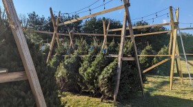
It might seem counterintuitive, but harvesting holiday trees year after year is better for the environment than using an artificial one, experts said, especially amid the proliferation of plastic piling up in landfills.
-
Officials on Wednesday reviewed several preliminary transportation policy strategies for the Valley's priority climate action plan. The plan’s focus is to reduce carbon emissions from transportation, a significant driver of greenhouse gas emissions across the region.
-
More than three dozen projects in the Valley were awarded grants, receiving about 7% of the total funding awarded. Statewide, $335 million in grants were announced Wednesday.
-
"Turn around, don't drown", warned a spokesperson for PennDOT. More than once today, people in the Valley have had to be rescued from their cars after driving into water that shut their engines off, trapping the drivers.
-
Some parts of the Lehigh Valley saw more than four inches of rain from Sunday into Monday, with precipitation still falling.
-
Schools are closing early and a large swath of the region is under a flood warning until at least 3:15 p.m. as the storm system that inundated the area overnight moves north.
-
The winter, or December, solstice takes place this year between sundown on Dec. 21 and sunrise Dec. 22
-
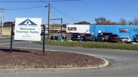
The Lehigh Valley Planning Commission at 11 a.m. on Wednesday is holding a meeting at its Allentown office to brainstorm and prioritize ways to decarbonize transportation across the region. Decarbonization is the process of reducing or eliminating carbon dioxide emissions.
-
Many spots could receive 2 to 3 inches of rain, forecasters warn, with areas of flooding possible Sunday night as another coastal storm targets the region.
-
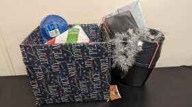
Amid the joy and festivities, environmental advocates are urging residents to keep sustainability in mind during what can be a time of year when trash and waste spikes.
-
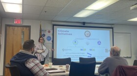
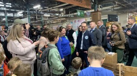
State environmental officials on Thursday evening hosted the last of five public engagement sessions, as they work to create a Priority Climate Action Plan, or PCAP, aiming to reduce greenhouse gas emission statewide and mitigate further effects of climate change.