LOWER MACUNGIE TWP., Pa. — Lower Macungie Township is mapping out the future — literally.
Lower Macungie's Board of Commissioners recently approved a new official map of the township that is more than just updating road extensions and township-managed parks and open space.
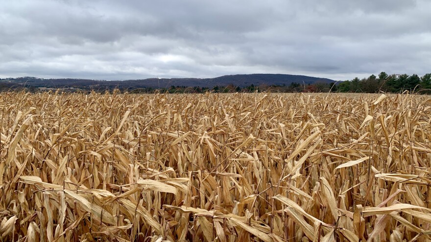
It also identifies land for which the third-largest Lehigh Valley municipality hopes to acquire development rights as part of its goals to preserve farmlands and forests.
The new map identifies many more plots of land in the western half of the township for future desired acquisition, and updates markings of where new developments and roadway completions have occurred.Compared with the prior Lower Macungie Township map
Official maps are ordinances "designed to implement the goals and community vision set forth in the comprehensive plan," according to a handbook for preserving and providing public lands and facilities produced by the state Department of Conservation and Natural resources in collaboration with other government agencies and nonprofits.
It outlines plans for such things as transportation, recreational parks and trails and open space, and is separate from an official zoning map of a municipality.
Lower Macungie Township New Official Map by LVNewsdotcom on Scribd
Compared with the prior official map, the new map identifies many more plots of land in the western half of the township for future desired acquisition, and updates markings of where new developments and roadway completions have occurred.
The map also shows the successful township preservation of areas such as the five-parcel, 106-acre "Dorney Tract" along Lower Macungie Road near Emmaus and the 135-acre "Lichtenwalner" farm on Indian Creek Road.
'Potentially an opportunity'
Since a 2021 referendum, Lower Macungie Township has had an open space earned income tax of 0.15% budgeted out to 2026, after which officials say it would require an additional referendum by township residents to continue.
"When we had proposed the tax, [Lichtenwalner farm was] one of the areas that farmland was designated, and we knew that was potentially an opportunity for us on Lower Macungie Road," Township Manager Bruce Beitel said.
"So out of that collection that we anticipated to have, we spent $6 million on that land."
"It seems the residents are very supportive of that tax and our efforts, the open space map, what we can do on that. And we've heard very positive feedback."Lower Macungie Township Manager Bruce Beitel
According to the township, more than 900 acres has been preserved so far.
That raises funds specifically toward buying, paying off and maintaining open space.
In 2024, anticipated revenues for that tax are $2,050,000.
In the original referendum, open space was defined as “greenways, active recreation areas and passive open space used to preserve forests, parks, urban gardens and other green places.”
"We're fortunate," Beitel said. "It seems the residents are very supportive of that tax and our efforts, the open space map, what we can do on that. And we've heard very positive feedback."
Lower Macungie is not alone in such updates and goals.
Emmaus recently passed a new official map as part of its zoning and land use overhaul, while South Whitehall Township is taking steps to include an open space tax of its own on the 2024 ballot.
A tool for open space preservation
Lower Macungie Township Director of Planning and Community Development Nathan Jones said marking land for potential future public use on an official map is a legal tool that allows municipalities a “seat at the table” when it comes to negotiations for buying land.
According to the municipal open space handbook, once a property owner or developer notifies a municipality of their intention to build, subdivide or perform other work on land that is on an official map, the municipality has up to a year to confirm its own acquisition interest and negotiate to acquire the land, which Jones said would be purchased at market rate.
"It's about finding the balance of preserving the properties that are both affordable to do so and carry the highest value."Lower Macungie Township Director of Planning and Community Development Nathan Jones
The official map can be used to help the township buy farmland, which is then leased to farmers. It is permitted certain uses, such as the keeping of livestock, agricultural accessory buildings, a single-family farmstead per lot and crop fields, according to the township.
The map also helps the township preserve forests and natural space for conservation, which Jones notes maintains character while doubling as stormwater management and flood reduction.
"It's about finding the balance of preserving the properties that are both affordable to do so and carry the highest value," Jones said.
Preserving open space a 'balancing act'
Jones said the township also works with the Wildlands Conservancy nonprofit and Lehigh County with its open space preservation efforts.
Jones said the township's efforts to preserve open space always are a “balancing act” because the state’s land use laws often favor the rights of landowners.
"But we did receive a mandate from the voters.”Lower Macungie Township Director of Planning and Community Development Nathan Jones
“Pennsylvania's development laws are very clear,” Jones said. “We are a land use rights state. And if someone wishes to improve or subdivide their property, they have the right to do that.
"But we did receive a mandate from the voters.”
He said that while the purchase of all land is impossible because of the high value market, it helps to rank the township's priorities for when opportunities become available.