Bethlehem Live Weather Camera sponsored by St. Luke's University Health Network
-
 A program at Rodale Institute aims to develop a diverse pipeline of highly skilled professionals to serve the certified organic industry throughout the state. Pennsylvania is third in the nation for organic commodity sales.
 -
East Stroudsburg University’s resident astronomer is leading a stargazing program at Louise W. Moore Park. It's is free and open to all ages 6 and up, but registration is required.
-
The parcel was manifested as “pieces of silk to be used in works." It was seized at Philadelphia International Airport and headed for northeast Pennsylvania.
-
While parts of the Lehigh Valley were able to get a glimpse of the Northern Lights over the weekend, weather conditions kept many from being able to enjoy the show. Now, the solar storm the pushed the aurora to the lower latitudes is waning.
-
WLVR’s Brad Klein reviews the week’s astronomical highlights with Bethlehem’s ‘Backyard Astronomy Guy,’ Marty McGuire. This week it's all about the star Regulus, which is part of the Leo constellation.
-
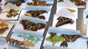
Christopher Sipos remembers his late-grandmother's love of birds but was pleasantly surprised to find her collection of antique baking soda trading cards that feature the feathered beauties.
-
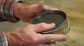
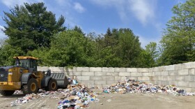
Theis/Cornfeld Recycling Center in Bethlehem accepts recyclables not only from city residents, but the general public, too. There, residents can see how the process works, first-hand.
-
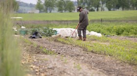
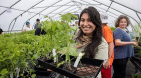
A handful of organic farms across the Lehigh Valley are welcoming residents and visitors this weekend to help their own gardens get growing.
-
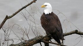
State Sen. Lisa Boscola, D-Lehigh/Northampton, sponsored the bill. Any money collected will go toward bald and golden eagle conservation efforts.
-
Easton City Council heard presentations for improvements intended for Vanderveer and Centennial Parks at their Wednesday meeting, and while the refreshed spaces were well received, the question of cost is still a concern.


-
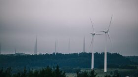
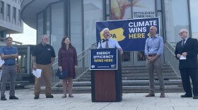
The proposal under consideration in Harrisburg would up Pennsylvania’s renewable energy goals from 8% now to 30% by 2030.
-
January is National Radon Action Month, and officials from the American Lung Association are offering a limited supply of free radon test kits for commonwealth residents, including those in the the Lehigh Valley.
-
The weekend storm threat would be the area’s first significant snowfall in years, but forecasters say we have a long way to go to determine the final impacts.
-
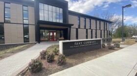
From 4:30 p.m. to 6:30 p.m. on Jan. 10, college officials are opening up the Fahy Commons for Public Engagement and Innovation, 2400 W. Chew St., for residents and community members to explore.
-
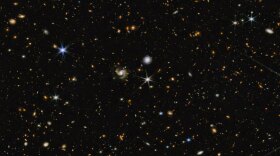
The James Webb Space Telescope, launched on Christmas 2021, orbits the Sun about a million miles outside Earth’s orbit. It is the most powerful, largest, and most complex telescope ever made.
-
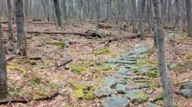
This New Year’s Day, tens of thousands of people across the country, including dozens in the Valley, will take a guided hike through a state park to mark the beginning of 2024.
-
December 2023 is now the wettest December on record in the Lehigh Valley, with a total of 8.17 inches of rainfall recorded as of 11:59 p.m. Wednesday. The high water mark was set during a day of record rain for Dec. 27.
-
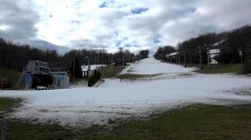
The ski slopes just southeast of Lehigh County announced it would shut down at 3:00 p.m. Tuesday, awaiting colder weather to make snow
-
With a forecast projecting 1 to 1.5 inches of rain possible this week, the Lehigh Valley will move closer to its wettest December ever.
-
Lawmakers in Harrisburg passed nearly three dozen laws last week in a final burst of action as they held their last voting session of the year.
-
Look for the full moon on Wednesday, Dec. 27
-
Take a look at stories that ran throughout the week of which we are most proud, had a profound impact on readers or that you might want to look at again.