BETHLEHEM, Pa. — This would have been a lot of snow.
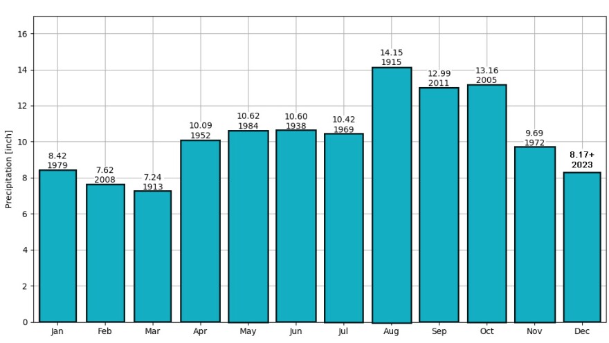
December 2023 now is the wettest December on record in the Lehigh Valley, with a total of 8.17 inches of rainfall recorded as of 11:59 p.m. Wednesday.
The previous record was back in 1973 with 7.89 inches.
The high-water mark was washed out in what also turned out to be a record-setting day of rain for the date of Dec. 27.
According to the National Weather Service, 2.05 inches of rain fell at Lehigh Valley International Airport on Wednesday. That easily broke the previous record of 1.55 inches for the date set in 1930.
In Center Valley, at least 3.03 inches of rain was recorded — the highest amount in the area.
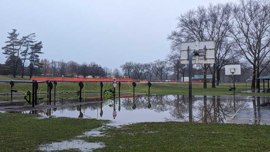
On Thursday, a flood watch remained in effect for Berks, Lehigh and Northampton counties until 7 p.m., with several creeks, streams and rivers at flood stage.
Poor weather was the cause of a power outage in Bethlehem Township early in the day, officials from PPL confirmed.
Approximately 1,023 customers lost power in the area of Oakland Road at 1:33 a.m. By 9 a.m., all but 411 had been restored, with an estimated restoration time for the remaining customers around 11 p.m., a spokesperson said.
It came about 8 hours after a power substation caught fire Wednesday nigh in Allentown, causing thousands in the city to lose power.

A train of storms
Assuming a ratio of 10:1 — 1 inch of rain equaling 10 inches of snow — the area could have been digging out from more than 80 inches of the white stuff this month.
Instead, contributing to the wettest December on record has been a train of storms — including two that brought daily rainfall records to the area.
A storm system on Dec. 10 dropped 1.59 inches of rain at the airport, also breaking the previous daily rainfall record of 1.40 inches set in 1969.
A week later on Dec. 17-18, a powerful storm system produced widespread flooding across the area after 3.27 inches of rain fell over two days.

County radio continually dispatched road closures and pump details, and numerous water rescues were reported.
Meanwhile, Wednesday’s record-breaker was a system that dropped 3 to 6 inches of rain over parts of the Carolinas and Georgia before it arrived in the Lehigh Valley.
“Storms tend to intensify as they increase in latitude (move north in the northern hemisphere) this time of year,” the weather service said on X.
Portions of the Carolinas and Georgia have received 3-6" of rain from this system over the past couple days. Storms tend to intensify as they increase in latitude (move north in the northern hemisphere) this time of year.
— NWS Mount Holly (@NWS_MountHolly) December 27, 2023
Temperatures notably above normal
In its latest forecast discussion, the weather service said chances of showers would diminish Thursday and winds would start to increase out of the west.
“That, however, opens the door for more patchy fog development, so clearing might be short-lived if there is any,” the discussion said.
“Again, temps don’t move much, but should drop into the low 40s for most. This is notably above normal for this time of year.”
For the month of December, the Lehigh Valley’s average monthly temperature has been 39 degrees — or 3.6 degrees above normal.
The precipitation departure from normal has been 4.75 inches, meaning the Lehigh Valley has received almost 5 inches above what normally falls in December.
EPAWA's 12/28 and week ahead outlook, covering:
— Bobby Martrich | EPAWA (@epawawx) December 28, 2023
■ Lingering showers for parts of the region today
■ Improving conditions over the holiday weekend
■ Where's the snow you ask? Patience is a virtue... https://t.co/STt8IPUmOz
So where’s the snow?
“We are going to turn cooler, relative to what we are now,” EPAWA meteorologist Bobby Martrich said in his latest video update, targeting Jan. 3-4 for a bit of a temperature swing.
“Once we get beyond that, we do have a colder air mass coming in beyond this point,” he said. “Our storm signals will be setting up maybe Jan. 7th through the 10th for a time frame. There’s one or two in there that we have to take a look at and watch closely.”


