Bethlehem Live Weather Camera sponsored by St. Luke's University Health Network
-
 A rare piebald deer, which has a distinctive white coat with patchy brown spots due to a pigmentation anomaly, has been seen in the Easton Cemetery. Such deer make up about 1% of the total whitetail deer population.
 -
Brad Klein reviews the week's astronomical highlights with Bethlehem’s "Backyard Astronomy Guy."
-
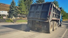
State police say someone has photos and they are investigating the sighting of a large feline — possibly a mountain lion — in a field in Lower Macungie Township on Sunday.
-
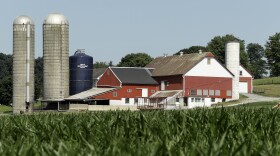
More than 1,336 acres across the commonwealth were preserved. Here are the Lehigh Valley farms now safe from development.
-
Take a look at stories that ran throughout the week of which we are most proud, had a profound impact on readers or that you might want to look at again.
-
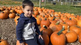
Rainy weekends have put a damper on attendance at fall festivals in the Lehigh Valley.
-
A potent system is still on the way to the area, the National Weather Service warned Friday, referencing a storm forecasters have been talking about for almost a week.
-
The initiative consists of a partnership between Northside Alive and PPL — the latter donating 500 special lightbulbs to the community.
-
PennEnvironment released data showing Pennsylvania ranks near the bottom when it comes to the growth of wind energy, solar power, energy storage and other renewable energy metrics over the last decade.
-
A powerful storm system expected to bring heavy rain to the region this weekend might not be a total washout, forecasters say.


-
Heat and humidity will build for the afternoon, heightening a severe weather risk for the Lehigh Valley on Friday, forecasters say. It comes before a heat wave arrives in the region next week.
-
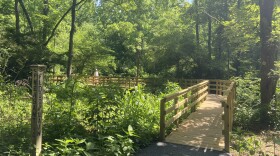
For the first time in more than three decades, and at a cost of nearly $500,000, the Boardwalk at the Dorothy Rider Pool Wildlife Sanctuary.has been completely restored and made compliant with the Americans with Disabilities Act.
-
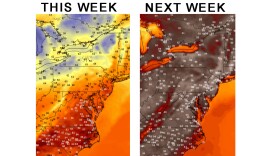
Heat index outlooks — projecting what it feels like outside with the heat and humidity combined — push feels-like temperatures near triple digits between June 17-21 and top 100 degrees in the Lehigh Valley between June 19-25.
-
More than two dozen state legislators, including one from the Lehigh Valley, have co-sponsored HB2238, which would eliminate the use of per- and poly-fluoroalkyl substances, or PFAS, in household products.
-
Allentown Environmental Advisory Council members on Monday night voted unanimously to submit comments to city officials on a proposed overhaul of zoning regulations, including eight recommendations.
-
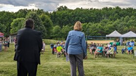
Northampton County's Parks and Recreation Division and the Lehigh Valley Greenways Conservation Landscape celebrated big anniversaries Monday during the Greenways Jamboree Monday at Wayne Grube Memorial Park.
-
State officials are holding a virtual town hall meeting Wednesday for residents to share their feedback on the Bureau of Forestry’s newest strategic plan. Here's how to participate.
-
The weather pattern this week will be a tale of two halves, with sunny skies and comfortable temperatures before things heat up in a big way. The region's first heat wave could also be looming, forecasters warn.
-
In this week's Watching the Skies, Brad Klein and Marty McGuire talk about how China landed a spacecraft on the far side of Earth's moon on June 1 to gather rock and soil samples.
-
The release is the first of a long list of fun summer activities planned for young readers at the library.
-
Officials gathered at the Lehigh Valley Zoo Thursday evening for a ribbon cutting to celebrate the opening of Rothrock Red Panda Peak. It's the first time the zoo has had red pandas in residence.
-
The complaint alleges Sunshine Act violations from the township supervisors and legal filings from the township solicitor with no official approval beforehand.