Bethlehem Live Weather Camera sponsored by St. Luke's University Health Network
-
 Lehigh Valley Zoo has confirmed its born-in-captivity kangaroo Hopscotch passed away last week, likely because of an infection that spread to her digestive tract.
 -
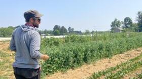
A handful of Lehigh Valley farms are feeling the impact of the federal funding freeze. It's also causing a Harrisburg nonprofit focused on sustainable agriculture to announce furloughs starting next month.
-
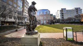
Ruffian Tittmann will start her job as executive director of the Allentown Parknership at the end of March.
-
Last year was a big year for dam removals not only in the Lehigh Valley, but across Pennsylvania. The state was ranked first in the U.S. for the most outdated, unsafe and uneconomical dams removed in 2024.
-
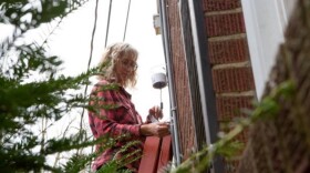
The Pennsylvania Invasive Replace-ive Program encourages property owners to remove invasive plants by offering native replacements, for free, during events in May throughout the state.
-
This week, a surprise twist on the total lunar eclipse visible from the Lehigh Valley in the early morning hours of Friday, March 14th.
-
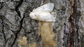
An invasive insect known for its voracious appetite that can defoliate millions of acres of forest, spongy moths have been an annual blight on the Valley and the rest of Pennsylvania for decades.
-
Formed in 2008, local weekend event in May features separate day of beer and wine tastings, followed by a for-kids-only day of art and science fun.
-
Center officials on Thursday opened the doors of its visitor and education center to highlight the building’s sustainable features. The Osprey House is an example of the opportunities nonprofit organizations can realize when it comes to energy efficiency, officials said.
-
A rehabilitation project on the Route 873 Lehigh Gap Bridge, which connects Washington Township, Lehigh County, and Lehigh Township, Northampton County, begins Thursday.


-
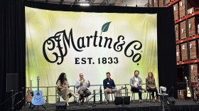
Martin Guitar welcomed guests from across the music industry to talk about protecting the environment at its first Sustainability Summit on Thursday.
-
Veronika Vostinak, Allentown's sustainability coordinator, on Wednesday gave a hourlong presentation to the Lehigh Valley Environmental Advisory Council Network on her experience with plastic reduction efforts, targeting single-use foodwares and reusables for dine-in.
-
While a full report is expected next year, researchers behind Lehigh Valley Breathes have released a data analysis, which includes three comparisons looking at fine particulate pollution across eight monitoring locations.
-
The Environmental Advisory Council on Tuesday unanimously voted to send City Council a letter stating the EAC’s intent to work on a dark skies ordinance and urging city officials to consider collaborating, then adopting it when the time comes.
-
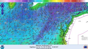
A reinforcing cold front has triggered a freeze watch in the Lehigh Valley from Thursday evening through Friday morning, bringing our coldest overnight temperatures since mid-April.
-
State environmental officials are calling on residents to nominate their favorite waterway to be 2026 River of the Year. The effort aims to elevate public awareness of specific rivers and recognize important conservation needs and achievements.
-
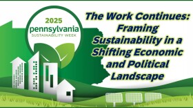
Between changes in federal policy and an unprecedented demand for energy, it's a tough time for sustainability. An hour-long panel Monday with industry experts focused on how to address those changes.
-
Days of temperatures in the mid to lower 80s will be wiped out by a cold front later this week, forecasters say, ending a bonus stretch of warmth and finally ushering in classic fall weather in the Lehigh Valley.
-
This week on Watching the Skies, WLVR's Brad Klein and Bethlehem's "Backyard Astronomy Guy" Marty McGuire dive deeper into the details of the upcoming Lehigh Valley Space Fest. The event will take place at Lafayette College Oct. 11-12.
-
More than two dozen events are scheduled, all focused on mitigating the impacts of climate change through educating and engaging the community.
-
‘A meaningful difference’: Easton to give away 200 trees to residents in disadvantaged neighborhoodsProperty-owning residents in Environmental Justice Areas are eligible for one free tree. The giveaway is scheduled for 9 a.m. to 11 a.m. Saturday, Oct. 11, at the city’s Recycling Drop-off Center.
-
City Council on Wednesday unanimously approved a $200,000 contract for Bethlehem-based WSP USA Inc. to help officials develop a comprehensive strategy to meet climate-related goals.