-
 Forecast guidance continues to indicate precipitation can be expected over the region Friday evening, which could leave a blanket of white in some areas as we await the winter solstice.
 -
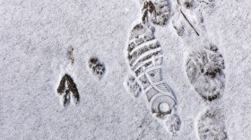
A nuisance system that moved through the region Sunday night brought the Lehigh Valley its first measurable snowfall of the season, the National Weather Service said.
-
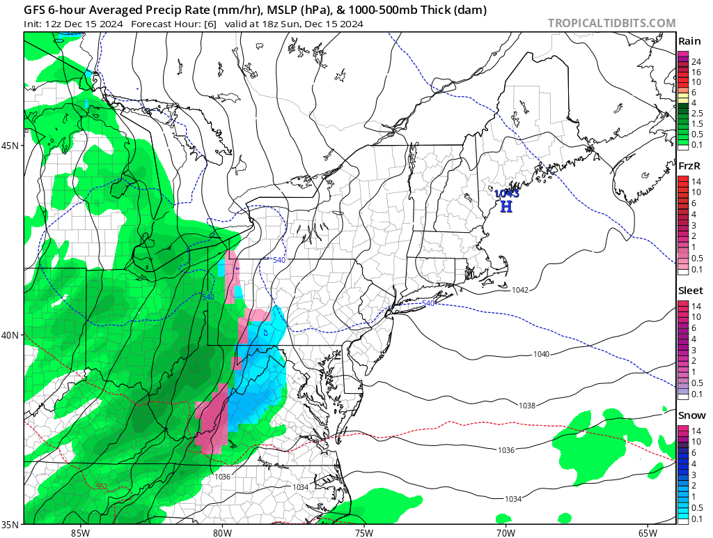
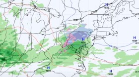
The National Weather Service issued a winter weather advisory mid-Sunday afternoon, warning of potential slippery conditions as mixed precipitation moves through the Lehigh Valley into early Monday morning.
-
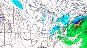
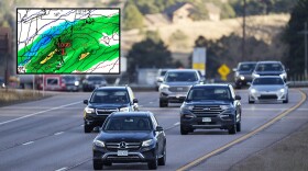
A system arriving Sunday night could bring a period of snow and ice to the area before a changeover to rain but “there remains considerable uncertainty with the details.”
-
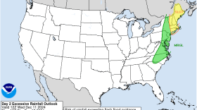
The rainfall is expected to be heaviest Wednesday afternoon and evening as a cold front approaches, with forecasters not ruling out some rumbles of thunder possible in the Lehigh Valley.
-
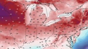
'It's time to dust off those winter jackets': Arctic air has arrived, and it's going to stay a whileHighs in the 30s and lows mainly in the 20s are forecast for the weekend and well into next week, which could be jarring on the heels of one our warmest Novembers on record.
-
Guidance “continues to trend towards a warmer solution for Thursday’s storm,” the National Weather Service said, meaning it's going to be a wet, not white, Thanksgiving.
-
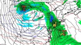
Forecasters have turned their attention to the end of next week, saying most model guidance indicates a storm system developing and affecting the East Coast — including the mid-Atlantic —around Thanksgiving Day and into Black Friday.
-
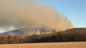
The drought is far from over, but enough precipitation has fallen to boost the confidence of state officials when it comes to outdoor fires.
-
After a steady – but not soaking – overnight rain, the area remains on track to break a pair of records that have stood the test of time. But more precipitation is on the way, including snow.

Your Local News | Allentown, Bethlehem & Easton
Play Live Radio
Next Up:
0:00
0:00
Available On Air Stations