
BETHLEHEM, Pa. — After falling just short of record rainfall Thursday, the Lehigh Valley has a frightening forecast for Halloween.
A wind advisory goes into effect at 10 a.m. Friday for much of eastern Pennsylvania and northern New Jersey, as strong westerly winds sweep through the region.
It comes behind the departing system that dropped 1.47 inches of rain in the Allentown area.
The record rainfall for Oct. 30 was 1.50 inches, set in 1917 and 1935.
Wind advisory
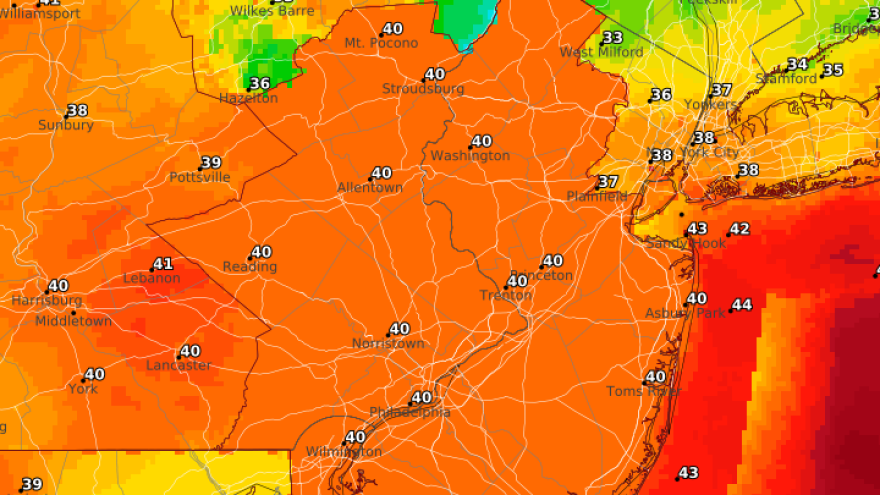
Forecasters say sustained winds of 20 to 35 mph and gusts up to 50 mph are likely across the region, especially in higher elevations and along the coast.
The strongest winds are expected from mid to late afternoon, gradually easing late but remaining gusty through midnight.
EPAWA meteorologist Bobby Martrich said common gusts in the Lehigh Valley should be 30 to 40 mph, perhaps with some gusts in the lower 40s.
He said the shore points and areas in the higher elevations will see the strongest winds.
The conditions could make trick or treat a challenge, as gusty winds could blow around unsecured objects outdoors.
Power outages possible
The combination of saturated ground from Thursday’s rain and lingering foliage could increase the risk of downed trees and power outages, particularly near and south of the Philadelphia area, according to the National Weather Service.
Otherwise, skies will stay mostly cloudy for much of the region, with more sun expected well south of the Lehigh Valley.
Highs will reach the mid-50s to near 60 degrees, dropping into the 40s overnight as winds slowly diminish.
Daytime Saturday could still be a bit breezy at times with gusts up to around 25 mph possible, the weather service said.
However, it will be an otherwise dry and partly cloudy day with highs in the mid 50s.
Winds will finally begin to relax Saturday night, and highs Sunday look to be in the upper 50s under mostly sunny skies.
