- Ophelia made landfall on North Carolina's coast, bringing impacts to the southeastern and mid-Atlantic U.S. coasts
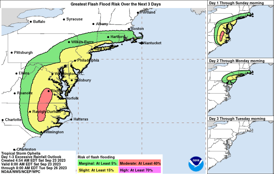
- The storm is expected to cause heavy rainfall across the Mid-Atlantic states, potentially leading to flash and urban flooding
- Ophelia is anticipated to weaken over the weekend as it tracks across the Lehigh Valley and departs on Monday
- A local event has been postponed due to the severe weather condition
ALLENTOWN, Pa. — The Lehigh Valley is still under the influence of Tropical Storm Ophelia.
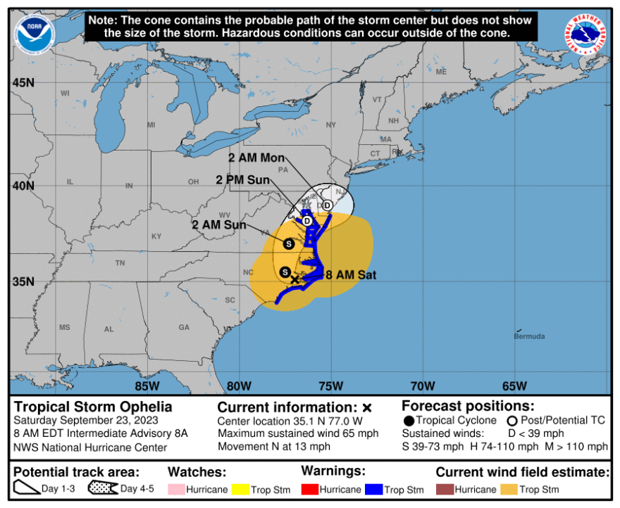
Early this morning, Ophelia made landfall along the coast of North Carolina, bringing with it a host of weather impacts, National Hurricane Center reports.
Tropical storm conditions are now anticipated along the southeastern and mid-Atlantic coasts within the Tropical Storm Warning area through tonight.
The system is expected to bring heavy rainfall, which may lead to flash flooding and urban flooding across the Mid-Atlantic states from North Carolina to New Jersey through Sunday.
However, Ophelia is projected to weaken to a remnant area of low pressure over the weekend as it tracks across the Lehigh Valley, eventually departing by Monday.
Weekend forecast
The Lehigh Valley today can expect periods of rain with a high near 60. Breezy conditions will persist, with a northeast wind of 15 to 20 mph, gusting as high as 35 mph. There's a 100% chance of precipitation with new amounts between a quarter and half of an inch possible.
As for tonight, there will be more periods of rain with a low of around 56. Breezy conditions continue, and the chance of precipitation is 80%. New amounts between a tenth and a quarter of an inch are possible.
Rainfall will continue on Sunday while gradually tapering off after 8 a.m. The high temperature will reach around 63. The day has an 80% chance of precipitation with new amounts between half and three-quarters of an inch possible.
Moving into Sunday night, chances of showers are still at 80%, with a low around 57. The northeast wind will slow down to between 10 to 15 mph.
According to the forecast, swells generated by Ophelia will affect a significant stretch of the U.S. East Coast through the weekend. It is likely to result in life-threatening surf and rip currents.
Easton event postponed
Easton’s College Hill PorchFest, a free annual event that invites residents to perform and enjoy music together, has announced on Facebook that it’s put off due to the unstable weather.
“We are sad to say that College Hill PorchFest is POSTPONED to our rain date of Sunday, Oct. 1. We hope you can still come out in a week to enjoy this great day of music and community,” the post writes.
It was the first time the event has ever been postponed, as the four previous years have seen only wonderful weather.
Stay tuned with us for any new tropical storm updates.