

BETHLEHEM, Pa. — As the first week of June unfolds, the Lehigh Valley will experience a notable rise in temperatures, forecasters say.
The abundant sunshine and steady warming will come after another unseasonably chilly start, with temperatures dropping to 43 degrees Monday morning.
Highs are expected to reach 73 degrees by the afternoon, with perhaps a thin veil of haze attributed to smoke from Canadian wildfires.
The National Weather Service said the haze could be more apparent toward the late afternoon and evening hours, particularly at sunset.
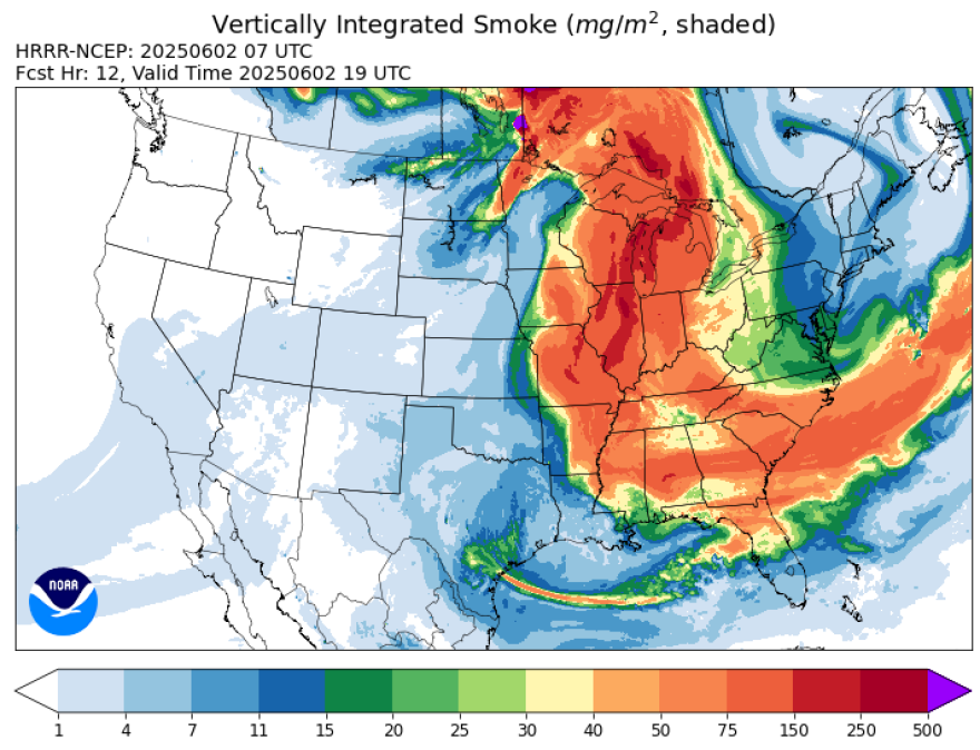
“Thankfully, we do not expect the smoke to reach the ground and cause any air quality issues at the surface at this time,” the latest NWS forecast discussion said.
Here’s the breakdown on what to expect this week:
Tuesday through Thursday
The early to midweek period will see temperatures tick up each day, with dry weather expected as an area of high pressure lingers offshore.
The setup will bring a warm southwest flow across the region, with highs near 80 on Tuesday and into the mid 80s by Wednesday.
Lows are expected to range from the mid to upper 50s Tuesday night and not cooling below 60 on Wednesday night, the forecast discussion said.
“This time of year this (pattern) is a heat pump high, Bermuda high, whatever you want to call it,” EPAWA meteorologist Bobby Martrich said in his latest video update.
Martrich said the strong upper level ridging pattern will help keep conditions warm and dry, but as the week progresses humidity levels will increase.
The warmest day of the week still appears to be Thursday, with widespread upper 80s and even a few 90s across the region.
Rain returns
After 10.45 inches of rain in May — good for the second wettest May of all time in Allentown — wet weather will return to the area by week’s end.
Forecasters say as the pattern breaks down, it will heighten the risk of unsettled weather, particularly by Friday and Saturday.
"There still remains a bit of differences in the exact details and timing across global guidance, but the general consensus places rain chances Friday and Saturday,” the weather service said.
Highs should be in the mid to upper 80s on Friday, but with increased cloud coverage.
Temperatures will bump down to the low to mid 80s Saturday ahead of a cold front, which will bring seasonable temperatures after, with highs falling back into the 70s.
