
BETHLEHEM, Pa. – A significant storm is set to soak the region this week, meteorologists say, and it will come during the peak travel days ahead of Thanksgiving.
Climatologically-favored areas in the northern tier could even see a wintry aspect to the storm, EPAWA meteorologist Bobby Martrich said in his latest video forecast.
Negative travel impacts associated with the system should be Monday to Tuesday in the Midwest and from Tuesday to Wednesday in the Mid-Atlantic and Northeast.
More than 55 million people are expected to travel during the week-long stretch around the Thanksgiving holiday, according to AAA.
The National Weather Service said the latest forecast models remain in decent agreement, and no major changes have been made to the forecast.
Our first good soaking rain in weeks is forecasted to arrive Tue afternoon through Wed morning. While the rain is much-needed, it will come at a small cost: gusty winds 25-35 mph (with localized gusts up to 45 mph along the coast) and some coastal flooding possible. pic.twitter.com/PpNkwP6F06
— NWS Mount Holly (@NWS_MountHolly) November 20, 2023
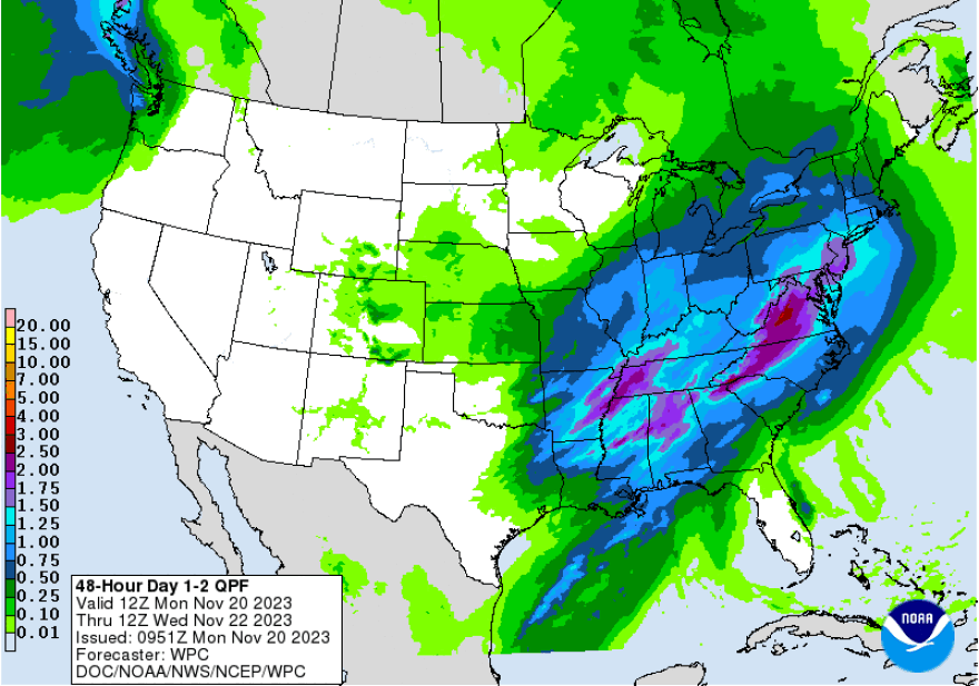
Timing, precipitation and impacts
The system arriving Tuesday into Wednesday is expected to provide the region with the first good soaking rain the area has seen in a few weeks.
Forecasters say a warm front will arrive Tuesday night, followed very quickly by a cold front Wednesday morning.
Clouds are expected to arrive well ahead of the system, with wind gusts reaching 20 to 30 mph by Tuesday night.
EPAWA's 11/20 and week ahead outlook, covering:
— Bobby Martrich | EPAWA (@epawawx) November 20, 2023
■ Timing of Tuesday's system and expected amounts
■ Identifying areas of wintry mix/snow at the onset
■ A look at the next system late week/early weekendhttps://t.co/V9Qmayg7sG
The timing for onset of precipitation will be Tuesday afternoon, overspreading the region west to east throughout the afternoon and into the evening. In the Lehigh Valley, showers should start to move in by mid-afternoon.
“It will evolve into steady periods of rain and then some heavier rain for the vast majority of the region,” Martrich said.
The weather service said general rainfall totals will be in the 1 to 2 inch range, with local amounts potentially reaching as high as 3 inches for some locations.
Northwest winds behind the cold front Wednesday afternoon could also be quite gusty, around 20 to 25 mph, as the system departs the region.
A wintry aspect for some?
Rain is still expected to be the main precipitation type throughout the event, but both Martrich and the weather service said some wintry precipitation will be possible across the Poconos at the onset Tuesday afternoon.
“Everywhere will change over to rain. We’re not looking at a snowstorm here or a surprise event,” Martrich said.
The potential for snow or sleet will depend on “how robust the cold air damming is” ahead of the warm front, the weather service said.
Cold air damming, or CAD, is often referred to as “the wedge” and is a meteorological feature that needs a mountainous range to develop. It occurs when cold air becomes entrenched against the windward side of the mountains. Since it cannot rise over top, it is pushed down into a shallow layer near the surface.
As the precipitation rides up and over that layer of colder air, it can lead to wintry precipitation.
“Any frozen precipitation would be brief, and with still relatively warm ground temperatures, expect little in the way of accumulation or wintry precip impacts,” the weather service said in its latest forecast discussion.
