
BETHLEHEM, Pa. – Your best-laid plans to hit the road for Thanksgiving could be upended next week, forecasters warn.
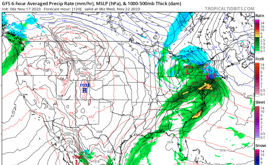
“Medium-range guidance remains consistent with indications of a potentially major storm system impacting a large portion of the eastern U.S. in the Tuesday-Wednesday time frame,” the National Weather Service said in its latest forecast discussion.
That’s bad news for anyone set for a holiday getaway, and AAA projects some 55.4 million travelers will head 50 miles or more from home over the Thanksgiving holiday travel period — an increase of 2.3% over last year and the third-highest Thanksgiving forecast since AAA began tracking holiday travel in 2000.
If you’re one of them, it will be worth watching forecast updates over the next few days.
What we know
"This is going to be a primarily rain system for the vast majority of the region,” EPAWA meteorologist Bobby Martrich said in his Friday video forecast.
“I know there’s some speculation this could turn into a big winter storm. I don’t see it,” Martrich said. “I don’t see any support for that kind of idea for this particular event.”
EPAWA's 11/17 and week ahead outlook, covering:
— Bobby Martrich | EPAWA (@epawawx) November 17, 2023
■ Timing the showers today/tonight with a cold front
■ Much cooler weather follows the front this week
■ Next chance for rain could be an area-wide soakerhttps://t.co/jOkECecu54
What the experts do know is that they’ll be watching closely within the guidance as to how the system will impact our region.
“This should be much-needed rainfall and there could be low pressure enhancement as [one low pressure system] moves up into the Great Lakes,” Martrich said.
“I know there’s some speculation this could turn into a big winter storm. I don’t see it. I don’t see any support for that kind of idea for this particular event."Meteorologist Bobby Martrich
That will be on the lead of a big, deep trough, Martrich said, and it’s expected to transfer energy to a secondary system that’s projected to move straight into the Mid-atlantic region.
The potential phasing of those pieces is what meteorologists will be watching to learn how the system should impact our area.
“This synoptic setup will favor cyclogenesis,’ the weather service said, or enhancement of the rainfall.
What we don’t know
The exact details still remain unclear at this time due to the storm being five days out, but the weather service said the setup could mean a “notoriously difficult wind forecast.”
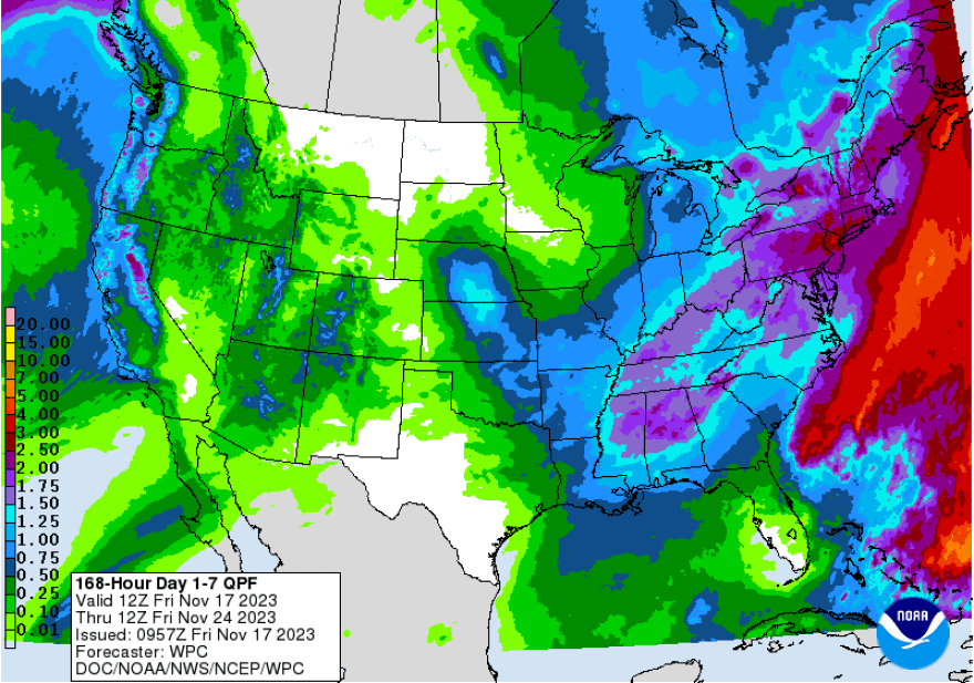
Additionally, early indications are that somewhere around 1 to 2 inches of rain are possible, perhaps locally more or less than that.
“The devil will be in the synoptic details as far as impacts are concerned, but anything from heavy rainfall and flood, to severe weather and thunderstorms, to high winds, to coastal flooding all remain on the table within the Tuesday through Wednesday period,” the NWS forecast discussion said.
"Anything from heavy rainfall and flood, to severe weather and thunderstorms, to high winds, to coastal flooding all remain on the table."National Weather Service
But it concluded with the same thing Martrich predicted — a setup not favorable for impacts from wintery weather, but certainly something worth keeping a close eye on as we near the busy travel days before Thanksgiving.
