
BETHLEHEM, Pa. — A strong storm system will bring gusty winds and heavy rain to the Lehigh Valley beginning late Wednesday night and into Thursday, forecasters say.
According to the National Weather Service, the storm is expected to bring a round of widespread moderate to heavy rainfall on Thursday, along with potential for strong easterly winds gusting to 30 mph, with stronger winds near the coast.
An isolated severe thunderstorm with damaging winds can't be ruled out in some areas, the latest NWS forecast discussion said, with strong westerly winds as the storm departs on Friday.
Similar to a nor’easter?
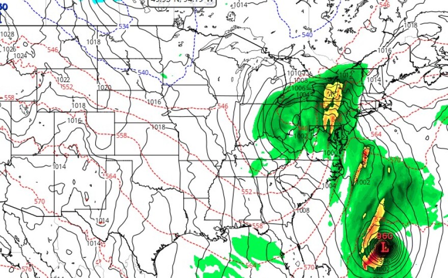
The storm looks like it “will try to spawn a secondary area of low pressure,” meteorologist Bobby Martrich of EPAWA Weather Consulting, said, bringing conditions similar to a nor’easter.
"If [Hurricane] Melissa wasn’t [a factor], there would probably be an easier transfer from one low to the next,” Matrich said. “But it’s having trouble because it’s competing with the energy from" Melissa.
Historic Hurricane Melissa crossed Jamaica on Tuesday as a Category 5 storm, tying the strongest hurricane landfall on record in the Atlantic basin for both pressure and wind speed.
It was expected to impact Haiti and the Dominican Republic on Wednesday, along with eastern Cuba, the Bahamas and Turks and Caicos.
Melissa has changed the way our system will behave Thursday, Martrich said.
“People like to say if this was January how much snow we would get," he said. "In this case, in January, [Melissa] is not going to be here. We’re not going to have hurricanes out there in January.”
He said that because there won’t be an easy transfer that looks and behaves like a true nor’easter, expected rainfall amounts have increased because of the lack of a dry slot and the storm “not handing energy off that quickly.”
Timing, amounts, conditions
Here are our latest expectations on the storm system impacts this week. Not much change, but rainfall expectations have ticked down a little while the severe storm risk has also diminished a little. Meanwhile, winds have ticked up a little Thursday. pic.twitter.com/pRbPIrGnfw
— NWS Mount Holly (@NWS_MountHolly) October 28, 2025
The weather service said periods of light to moderate rain are expected to move in after midnight from southwest to northeast, continuing and intensifying into the day on Thursday.
A widespread 1 to 2 inches of rain is likely within the Wednesday-night-through-Thursday period.
“This is probably the best projection I can find,” Martrich said, pointing to expected precipitation totals in the Lehigh Valley around an inch to an inch and a half, with some locally higher amounts.
Some models are projecting those totals, Martrich said, while others suggest more than 2 inches of rain could fall.
We’re also looking at 15 to 25 mph winds, with gusts exceeding 30 mph, he said, and widespread 30 to 40 mph gusts can be expected on Friday.
“This should start to diminish once we get past the evening hours on Friday,” Martrich said.
