

BETHLEHEM, Pa. — Another wave of heat is forecast for the Lehigh Valley and a large swath of the region in the coming days.
The National Weather Service has issued a heat advisory in effect from 10 a.m. Thursday to 8 p.m. Friday for heat index values — a measure of how hot it feels, factoring in humidity — around 100 degrees.
The advisory covers Berks, Lehigh, Northampton and Bucks counties. In New Jersey, it covers Morris, Warren and Hunterdon counties.
The greatest heat risk will be in the lower elevations and valleys, the advisory says.
Thursday is the Preview Night for Musikfest, the 11-day festival taking over both North and South Side Bethlehem.
"Thursday might be the most hot and humid day of the festival," said meteorologist Bobby Martrich, whose EPAWA Weather Consulting is the exclusive weather forecast provider for Musikfest.
Millions under advisories, warnings
The latest round of heat not only is forecast for this area, but for much of the Lower 48 through the first week of August.
But some of the warmest temperatures are forecast in the central states, not the Mid-Atlantic or Northeast.
Overall, dozens of states were under heat advisories Wednesday, and others under excessive heat warnings for even higher temperatures.
By late week, the weather service said records could fall in many locations, establishing new daytime highs and record high overnight lows.
Then there are the wildfires.
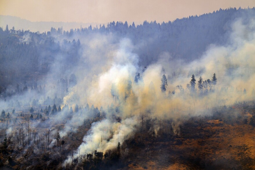
The Park Fire, the largest wildfire in California this year and the sixth-largest in the state’s recorded history, was among more than 100 large active wildfires burning in the United States this week, the Associated Press reported.
Some of the fires were sparked by the weather, with climate change increasing the frequency of lightning strikes, experts said.
Smoke from those fires out West and others in Canada drifted into the region days ago and will continue to hang around. And while it hasn’t greatly affected air quality, models show more smoke could push into the area in the days ahead.
Storms possible late-week
“Given the heat and humidity in place, there will certainly be decent amounts of fuel for storms,” the weather service said.
Storms could fire Thursday afternoon and again on Friday, and perhaps even into the weekend.
2:30am CDT #SPC Day3 Outlook Marginal Risk: from the Ohio/Tennessee Valleys to the Atlantic Coast https://t.co/K89lXjsUbi pic.twitter.com/hvdpZRJ05F
— NWS Storm Prediction Center (@NWSSPC) July 31, 2024
While forecasters say models are sufficient to support strong to marginally severe thunderstorms, only a marginal chance has been forecast during the late afternoon and evening hours on Friday.
The main threat with any storm will be locally damaging winds from an isolated downburst, the latest forecast discussion said.
