

BETHLEHEM, Pa. — Forecasters have a warning for those savoring the cooler spring temperatures that have dominated the month.
Your days are numbered.
Our windy and wet weather pattern is set to fade, and for those fully ready to embrace summerlike heat, your time is coming.
That’s the word from the National Weather Service, which says our frosty starts will be fleeting and a true thing of the past by next week.
The full jump from lows to highs Friday to Monday will be 50 degrees or more.National Weather Service
“Sunday and Monday will look to bring some of the warmest temperatures we have seen thus far,” with daytime highs set to jump as much as 20 to 25 degrees compared with the previous week, the latest NWS forecast discussion said.
The full jump from lows to highs Friday to Monday will be 50 degrees or more.
How we’ll get there
A freeze watch is in effect from late Thursday through Friday morning for sub-freezing temperatures possible.
The watch covers Lehigh, Northampton and Upper Bucks counties, with the possibility that frost and freeze conditions kill early season crops and other sensitive vegetation.
Temperatures will surge into the 70s and 80s over much of the region, with some areas even approaching 90 for the first time this year.National Weather Service
It would mark the 12th time this month overnight temperatures have dipped into the 30s, and the fourth time in five days they lingered around or below the freezing mark.
But a major — albeit brief — flip in the pattern will take place after, as forecasters say temperatures will surge into the 70s and 80s over much of the region, with some areas even approaching 90 for the first time this year.
While the Allentown area had a warm spell April 12-14 last year, it did not hit 90 or above until the first day of June.
Winter jackets to short sleeves
Forecasters say the pattern change ahead will be set up by a northward shift in the jet stream, with high pressure shifting to the south.
That will open the door to a southwest flow “to really crank up the warm air advection across the region,” the weather service said.
The surging warmth is expected to come to an end as a cold front pushes through the region TuesdayNational Weather Service
Temperatures Sunday are slated to push into the mid- to upper-70s, climbing into the mid 80s by Monday afternoon.
It’s expected to be mostly dry across the region during the timeframe, the weather service said, though a few isolated showers can’t be ruled out across the Poconos.
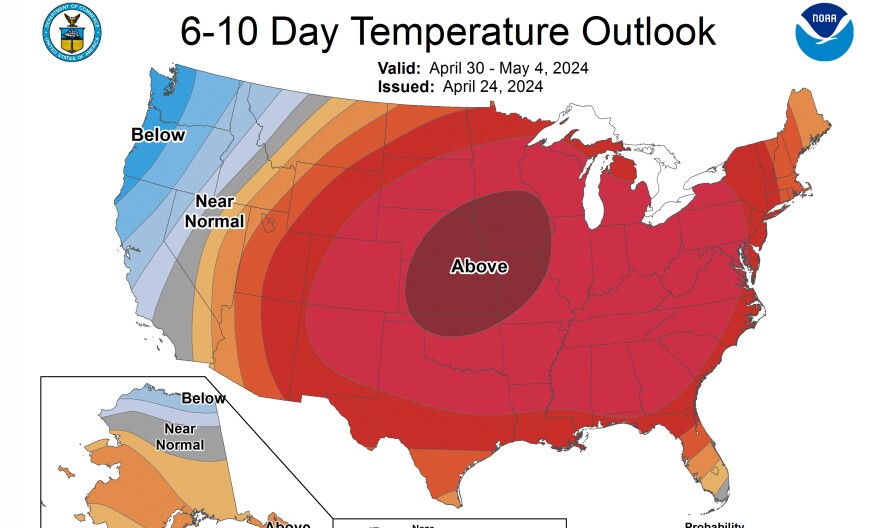
The surging warmth is expected to come to an end as a cold front pushes through the region Tuesday, though the Climate Prediction Center suggests temperatures will trend above average in the long term.
