BETHLEHEM, Pa. – Following a record dry May and a declaration of drought in June, the Lehigh Valley is looking at an extended period of warm, humid and wet weather ahead.
Meteorologists say the pattern will lock in for the end of the week, the weekend, and even into next week.
- The Lehigh Valley is in a drought watch, but with a warm, humid and wet pattern ahead
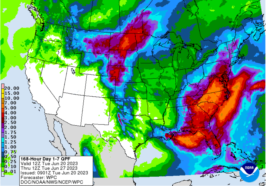
- Models suggests upwards of 3 to 4 inches of rain or more in the area from Thursday through the middle of next week
- It comes as a pattern known as a "Rex Block" is locked in
The changes come less than a week after Pennsylvania’s Department of Environmental Protection declared a statewide drought watch for all 67 counties, and the same day the region saw significant rainfall.
“Although this week has brought some welcome rain to much of the state, it’s not enough to make up for the lack of rainfall this spring, following a winter that brought little snowfall in many areas, DEP acting secretary Rich Negrin said in a news release on Thursday.
Negrin called for water conservation to start the summer, but under a drought watch the conservation is not mandated.
With the upcoming forecast, it also hopefully won’t become necessary.
What’s driving the pattern
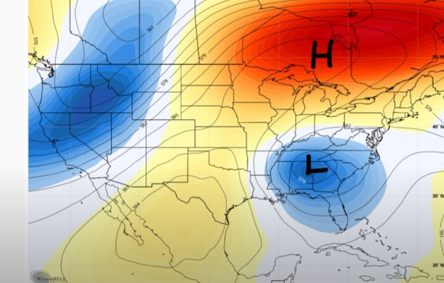
Meteorologist Bobby Martrich of EPAWA Weather Consulting said in his latest video forecast that a Rex Block – high pressure sitting over top of low pressure beneath it – is driving the pattern.
EPAWA's 6/20 and week ahead outlook. covering:
— Bobby Martrich | EPAWA (@epawawx) June 20, 2023
■ Isolated/stray shower in a few spots on Tuesday
■ Rex block breaks down late week, rain moves in
■ Near-daily shower/storm chances Friday onwardhttps://t.co/bJ14VdtItE
“This is good. This is warm temperatures and a very strong ridge,” he said, circling the high pressure area on the map. “And then you have this cut off upper level low to the south that’s sitting there, and it’s been sitting there for several days.”
But Martrich said the upper level ridge is “not going to hang in here very long” and will move quickly to the east and out into the Atlantic.
“In that void is this upper level low still sitting here,” he said. “It’s cut off from the flow and it’s going to kind of meander – at least the precipitation is – toward our region in the late-week period.”

Martrich said the problem is that the pattern is going to keep hanging around, not only through the weekend, but into early next week before another system moves in right behind it.
“We’re going to be dealing with the rain part of this, or associated with this, through at least midweek next week,” he said.
"We’re going to be dealing with the rain part of this, or associated with this, through at least midweek next week"Meteorologist Bobby Martrich
Models suggest significant rain ahead
The upcoming pattern has the look of a drought-buster if the numbers that model ensembles are putting out are even somewhat correct.
Martrich showed outputs from the European ensembles — which include over 50 members, or different model outputs blended together — that show 3 to 4 inches of rain in the Lehigh Valley from late Thursday night through the middle of next week.
“This is an average,” he warned, with outputs showing around 3.47 inches of rain predicted in Allentown. “There are some members that are not as rainy as others and there are some that are more.”
Martrich said some members of the European ensembles suggest 4, 5 or maybe even 6 inches of rain in parts of the region.
The government’s Weather Prediction Center suggests similar amounts, with precipitation forecasts showing t least 3 inches of rain in the area from Thursday through the following Tuesday.


