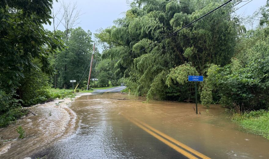
BETHLEHEM, Pa. — A heavy downpour Monday flooded streets and made for slow-going on the evening commute in the Lehigh Valley.
The National Weather Service issued a flash flood warning for the Allentown, Bethlehem and Easton areas until 9:30 p.m.
Flash flood warnings were in effect for several parts of eastern Pennsylvania and New Jersey.
A local weather observer reported 2.3 inches of rain had fallen in two hours in Emmaus by late in the afternoon, said National Weather Service meteorologist Patrick O’Hara.
“The rainfall rates with this system are fantastically high. And it’s very hit and miss,” he said.
Only a few tenths of an inch had been recorded at Lehigh Valley International Airport by 6 p.m., O’Hara said.
A flood watch will remain in effect across the area until 2 a.m. Tuesday, with localized amounts of precipitation over 3 inches possible.
“The rainfall rates with this system are fantastically high. And it’s very hit and miss.”Patrick O'Hara, National Weather Service meteorologist
The weather service warns that excessive runoff may result in flooding of creeks, dreams and other low-lying areas.

Flooded roads were reported in Upper Saucon Township, along Route 309, and along Main Road East and Main Road West in Upper Milford Township, near Leibert Creek.
Several roads around Upper Saucon Township were awash with large rocks and debris. Saucon Creek also flooded, surrounding a house right next to the waterway on Emmaus Road.
The storms were caused by a tropical air mass combining with an approaching cold front that forecasters earlier in the day said could dump 3 to 5 inches in just a couple of hours.
Several rounds of showers and thunderstorms are likely again Tuesday, with locally heavy rainfall leading to flash flooding, the latest forecast discussion said.


