

BETHLEHEM, Pa. — Rain, rain, go away.
It feels like it’s rained every weekend for months, and it kind of has.
The last fully dry weekend in the Lehigh Valley was April 19-20. That was the last time we saw a period that didn’t include a single rain drop from late Friday night through late Sunday into Monday.
We can thank a near-record May, which overpowered March and April — becoming our second wettest May ever — to make sure the spring season truly will end wetter than normal.
As we approach the summer solstice next week, the Lehigh Valley has:
- Received almost 7 inches of rain in the past month
- Recorded more than 11 inches of rain in the past three months
- Erased a year-to-date water deficit and entered Friday at 1.48 inches of precipitation above normal — the 29th wettest period against historical records dating to 1922 (with normals based on 2020 data from the National Weather Service)
‘Why doesn’t it flood anymore?’
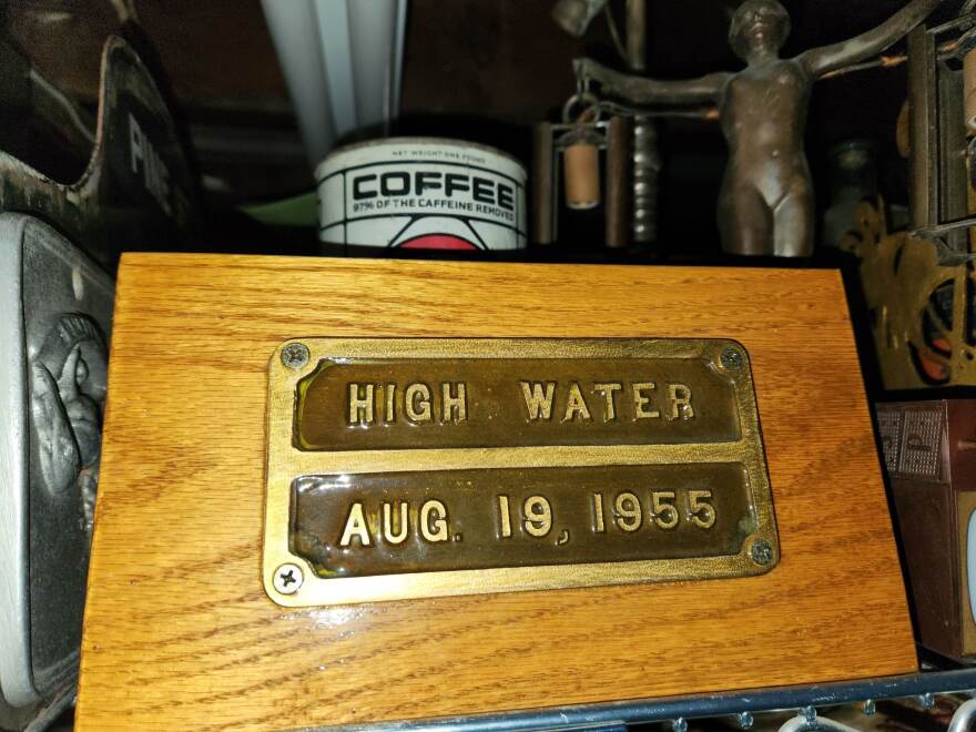
An inquisitive Redditor (that’s a casual term for users of Reddit) asked a pointed, if not timely question this week after watching YouTube videos of 1934, 1955 and early 2000s flooding in Easton: The last flood was in 2011. Does anyone know what caused an end to the constant flooding?
Many of those historic floods can largely be attributed to tropical systems and other major factors.
The Flood of ‘55 came in the aftermath of two separate hurricanes traversing the region within less than a week.
Connie produced 10 inches of rain in 48 hours, putting the Delaware River at flood stage.
Diane added another 10 inches less than a week later, according to the U.S. Army Corps of Engineers.
The remnants of Tropical Storm Allison hit the area in 2001, and Hurricane Ivan’s remnants in 2004 caused widespread flooding.
And, after the floods of 2004-2006 (attributed to a combination of snow melt and heavy rains), the Delaware River Basin Commission, the Corps of Engineers and local governments worked to address flooding along the river, especially reservoir operating plans to assess the downstream effect in order to help lessen flooding.
As of Friday, the Pepacton, Neversink and Cannonsville Reservoirs — part of the water supply that feeds into the Delaware — were above 100% usable storage, with Cannonsville releasing 388 million gallons per day; Pepacton’s release was around 194 million gallons, and Neversink was at 97 million gallons.
Tropics are calm – for now
The good news, despite a wet and dreary weather pattern ahead, is the tropics have been unusually calm so far this year.
The Atlantic Ocean has yet to produce a tropical storm since the season started. And while it’s not that unusual, the Washington Post pointed out Friday each of the last 10 seasons have featured a storm before June 20.
The report attributed the lack of activity to a lesser-known climate pattern called an Atlantic Nina, with tropical oceans, especially in the Atlantic, having cooled notably since last year’s record warmth.
“Because the subtropics have warmed significantly and the tropics have cooled, there’s less of a temperature difference, called a gradient, between the two regions,” the story said.
That leads to more stable, calmer atmospheric patterns in areas where storms typically form.
