
BETHLEHEM, Pa. — A seemingly relentless barrage of rain keeps soaking the Lehigh Valley, inundating streets and neighborhoods.
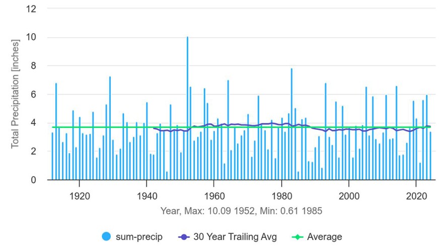
At least 3.39 inches of rain have fallen at Lehigh Valley International Airport, the area’s major climate site, since the beginning of the month.
Average rainfall for the entire month of April is 3.67 inches, meaning we’ve seen nearly a month’s worth of rainfall in just three days.
According to the latest data from the National Weather Service, it’s been sopping wet since March 1, with 8.53 inches total — a departure from normal of 4.53 inches.
Since Jan. 1, the area has recorded 17.18 inches of precipitation, or 7.11 inches above normal.
A record-setting start to the year
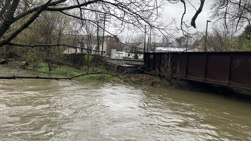
Flood warnings remained in effect early Thursday for parts of the area, including Lehigh County.
At 4:11 a.m., gauge reports indicated flooding occurring on the Little Lehigh in Allentown.
Around the region, flooding of rivers, creeks, streams and other low-lying and flood-prone locations also was reported as “imminent” as water continued to rise from the excess runoff.
The area saw 1.92 inches of rain Wednesday, shy of the record for the date of 2.04 inches set in 1975.
Flood-prone areas in Lower Macungie were closed, including Spring Creek Road. Macungie Road also was closed in the area of Krick Lane because of a tree down and flooding, and Riverbend Road was closed because of trees and wires down.
In Northampton County, the Bushkill Creek in Tatamy overtopped the cofferdam, posts on X showed.
The Bushkill Creek overtopped the coffer dam. Gage was 13.08 when photo was taken. The gage is visible on the left edge of the zoomed in photo. pic.twitter.com/iGmA6iB2lq
— Kris Alexander (@Timeismc2) April 3, 2024
Overall, it’s been an exceptional — and sometimes record-setting — start to the year, with daily maximum rainfall records set on March 24, March 9 and Jan. 9.
The record established Jan. 9 came just three days after a total of 5.3 inches of snow was measured at the airport, setting a record for the date, beating the 4.0 inches set in 2002.
Wet — and windy
Thousands lost power as strong winds battered the region on Wednesday.
Allentown’s Queen City Airport recorded a top wind speed of 48 mph, with Lehigh Valley International Airport hitting 47 mph.
Macungie saw gusts around 43 mph, while winds north of the area in Mount Pocono hit 53 mph around 12:13 p.m.
DeSales University ordered hundreds of students to evacuate certain residence halls and urged all others to return to their family homes in response to campuswide power outages.
Early Thursday, PPL Electric reported nearly 1,300 customers without power in Lehigh County and more than 1,400 in the dark in Northampton County.
Met-Ed reported 49 customers out in Lehigh and 100 in Northampton.
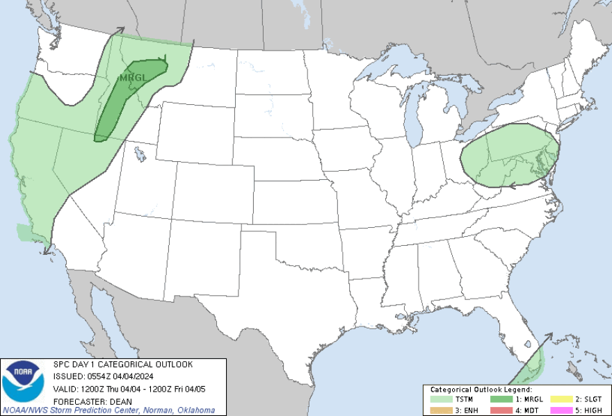
As utilities work to get the power back on, the Lehigh Valley could see thunderstorms Thursday afternoon.
The weather service said thunder and lightning are possible, and while we’re not expecting severe weather, “small hail cannot be ruled out given the environment.”
