- A hazardous weather outlook says scattered flash floods are possible Thursday into Friday
- The Lehigh Valley could see rainfall rates of an inch per hour
- The area is at a slight risk for excessive rainfall, with potential for localized amounts above 2 inches possible
BETHLEHEM, Pa. — The Lehigh Valley is at a heightened risk for heavy rainfall Thursday night, with scattered flash floods possible.
The Weather Prediction Center said one-inch-an-hour rainfall rates are possible, as well as “precipitation totals on the order of 1 to 2-plus inches through the period.”
It comes as a slow-moving complex of thunderstorms is expected to move from northeast Ohio into northwest Pennsylvania, “with forward propagation into PA and the southwest portion of NY state,” a forecast discussion said.
The National Weather Service issued a hazardous weather outlook, saying “most vulnerable are urban areas, roads, small streams and washes.”
Evolution
“We are going to have a warm front moving through the region,” EPAWA meteorologist Bobby Martrich said in his Thursday video forecast, describing heavy cloud cover anticipated throughout the day.
EPAWA's 8/24 and week ahead outlook, covering:
— Bobby Martrich | EPAWA (@epawawx) August 24, 2023
■ Warm front moves through today with showers
■ Cold front follows Friday with showers/storms
■ A look at the weekend/next week and the tropicshttps://t.co/w9vff4Mljo
“It’s going to be very slow, so it’s not going to be just a quick warm front moving through like we normally have. This is going to extend over many hours, going through the overnight.”
Martrich said that as the system eventually moves off to the north and east, there will be thunderstorms in its wake early Friday morning.
There also should be additional showers during the day Friday as a trailing cold front moves through, he said.
How much rain is expected?
According to the Weather Prediction Center, there is “some discrepancy in short range guidance on where the eventual complex will motion.
"But the steering pattern appears to be positioned over the south shore of Erie down to northern West Virginia on the southern extent and all point east through PA.”
As it moves into our area, the hydro threat shows precipitable water values in excess of 2 inches.
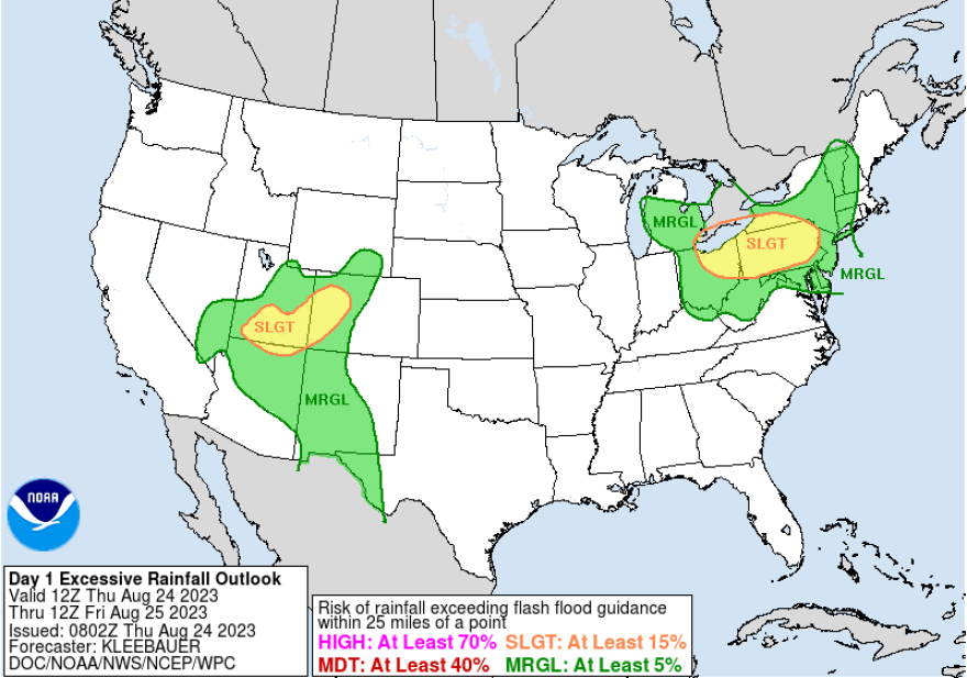
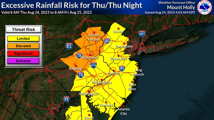
Periods of moderate to heavy rain are likely, and the Weather Prediction Center has the Lehigh Valley, Poconos and Berks County at a slight (2 out of 5) risk for excessive rainfall, with localized amounts in excess of 2 inches possible.

No severe weather threat
“I don’t want to get anybody alarmed here thinking this is going to be a severe weather event,” Martrich said. “We don’t have the timing or the atmospheric setup necessarily for severe weather.”
That means the thunderstorm risk won’t include damaging winds or any possibility of tornadoes, but Martrich said any of the storms could produce locally heavy rainfall.
“You could have some elevated convection that could lead to some lightning and thunder, but this is not a high wind or tornado type threat,” he said.


