BETHLEHEM, Pa. — Scorching temperatures have become a persistent reality in the Lehigh Valley to kick off summer, with an average high of 92 degrees over the past seven days.
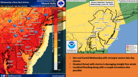
Wednesday will bring another scorcher, experts say, with maximum heat indices near 100 degrees depicted in bright shades of orange and red on the latest forecast maps.
Accompanying the heat has been a prolonged period of dry weather, with just 0.72 inches of precipitation measured for June — a nearly 3-inch departure from normal.
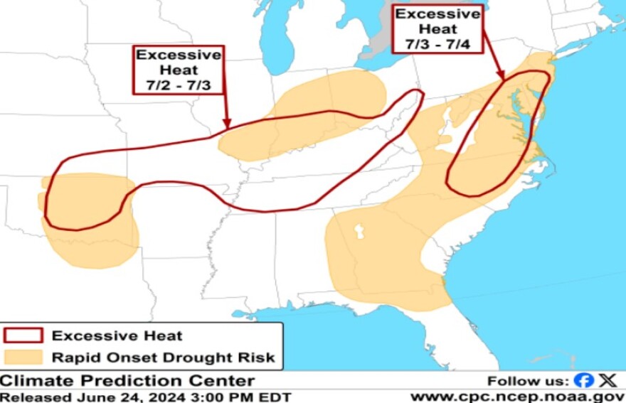
The lack of rain has landed the region in a risk area for rapid onset drought — a term that’s part of a new outlook issued by the Climate Prediction Center highlighting areas where a flash drought could develop.
The CPC uses specific criteria to determine vulnerable areas, including soil moisture values, along with areas experiencing 1- to 4-inch precipitation deficits over the previous 30 days that also have expectations of high heat and evapotranspiration rates for the next few weeks.
Evapotranspiration is defined as the transfer of water from the Earth's surface to the atmosphere and includes water from soil, water bodies and wet vegetated canopies and the transpiration of moisture from plants.
In contrast to a conventional drought, which mainly is driven by lack of precipitation over an extended period, flash droughts consider abnormally high temperatures, winds and/or incoming radiation that leads to abnormally high evapotranspiration rates, according to the National Integrated Drought Information System.
The Lehigh Valley meets all the criteria for a flash drought, with forecasters eyeing the possibility of another heat wave beginning around or after the Fourth of July.
'It's not looking that great'
While the CPC says periodic, localized heavy precipitation can't be ruled out because of frontal and/or daytime thunderstorm activity, no widespread heavy rainfall is anticipated soon.
Hot Weather and Recent Dryness Create Favorable Conditions for Rapid Drought Development. https://t.co/UMw8lZcKJV pic.twitter.com/Unqb9Al6oa
— NWS Climate Prediction Center (@NWSCPC) June 24, 2024
It’s an assessment with which EPAWA meteorologist Bobby Martrich agrees. Martrich said any robust storms that fire Wednesday could bring a half-inch or more of rain to isolated areas, with some showers likely to follow the initial line.
“Not a whole lot of that is going to run off, at least initially," he said. "So I don’t think it really does anything for abnormally dry conditions. It certainly doesn’t hurt, though.”
The bad news is that absent “a frontal passage here or there” along with pop-up thunderstorm chances, the long-term outlook appears exceptionally dry over the next couple of weeks.
Martrich said things might pick up during the second half of July and maybe early August, but it’s difficult to look too far out.
That period "turns around with maybe even slightly above-average precipitation during that time frame," he said. "But until then, it’s not looking that great."
Parts of Northampton County have been declared abnormally dry by the U.S. Drought Monitor, with an updated map expected to be released Thursday.


